
Everyone talks about the NC500. And yes, Scotland’s north coast loop is brilliant. But I’d argue there’s a stretch of tarmac on the other side of the Irish Sea that gives it a serious run for its money, and barely anybody in the English car scene has driven it properly. The Causeway Coast in Northern Ireland is genuinely one of the most rewarding drives in the British Isles, and in 2026 it’s still largely unspoilt by the motorway-bred, sat-nav-following crowds. If you’re the kind of person who reads torque curves for fun and has strong opinions about tyre sidewall height, this one’s for you.
I did this route in late spring, heading west from Ballycastle towards the Giant’s Causeway and then cutting inland through the Glens of Antrim on the return. What follows is the honest account, road feel and all, not a tourism board press release.
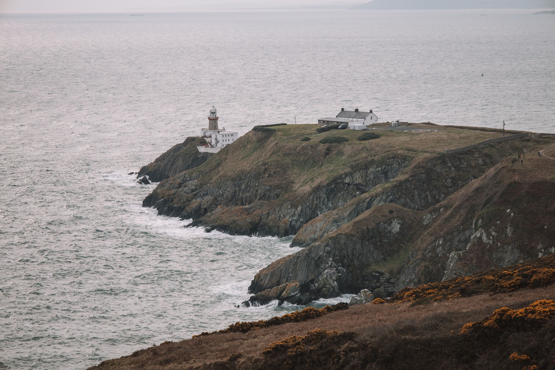
The A2 coast road: where the serious driving starts
The A2 between Ballycastle and Bushmills is the spine of any Northern Ireland driving route for car enthusiasts worth doing. It’s not wide. It’s not forgiving. And it rewards drivers who actually know what their front axle is doing. The road hugs the cliff edge in places, dropping away to the sea on your left, with dry-stone walls on the right giving you roughly zero run-off if you misjudge a late apex. Which, obviously, means you don’t misjudge it.
The surface is notably better than most of the B-road network I’ve driven in rural England or Wales. Northern Ireland roads, at least on the A-roads here, get reasonable maintenance, and you’ll find long sections of smooth, grippy tarmac that reward a properly set-up car. I was in a car with adjustable dampers and had them set two clicks stiffer than my usual road setting. Perfect call. The road is rhythmic in places, almost like a flowing rally stage, with the kind of medium-speed sweepers that let you feel exactly how your tyres are loading up. If you’ve ever driven Welsh rally roads for their fast, technical character, the A2 has a similar DNA, just with a more dramatic backdrop.
Between Ballintoy and the Giant’s Causeway car park, the road tightens considerably. There are a handful of sections that go full single-track with passing places, particularly around White Park Bay. Don’t rush these. Let touring caravans and tourists in hire cars take their time. The reward is the next open stretch, which more than compensates.
Ballycastle: your base and fuel logistics
Ballycastle is a solid starting point. There’s an Applegreen filling station on the edge of town on the A2 approach, which is your last guaranteed quick-stop fuel before you head west. Fill up here. Petrol stations thin out rapidly once you’re on the coast proper, and the one near the Giant’s Causeway visitor centre can have lengthy queues in summer. Diesel and unleaded are available; don’t expect to find any premium 99 RON fuel on this stretch, so if your engine is set up for it, plan accordingly.
For overnight stays, the Marine Hotel in Ballycastle has a car park that’s enclosed and relatively secure, suitable for a car you’d rather not leave on-street overnight. If you’re bringing something genuinely special, phone ahead and ask about the lower-deck covered spaces. I’ve also seen enthusiasts use Airbnb properties in Cushendall on the return loop, several of which have private drives or garages if you ask the host directly. Causeway Hotel at the Giant’s Causeway itself sits right on the cliff and has a National Trust car park adjacent, which is monitored during daylight hours, though overnight security is limited.
The inland B-roads through the Glens of Antrim
Here’s where this route properly separates itself from a standard tourist itinerary. After the Causeway, rather than retracing the A2, cut south on the B15 or the smaller unnumbered roads through Glenariff Forest Park and back towards Cushendall and Cushendun. This is the Northern Ireland driving route that car enthusiasts almost never talk about, which is a genuine shame.
The B-roads through the Glens are tight, cambered, and largely traffic-free outside of the school run window. The road climbs fast out of the valley floors, giving you proper elevation changes and a surface that varies between well-maintained tarmac and the occasional rough patch where hedgerows have pushed moisture under the edge of the road. Ground clearance matters here. I’d say anything below 130mm might want to take the A-road alternatives on the steeper descents. For a standard hot hatch or sports saloon, though, it’s perfect territory.
Glenariff itself is the standout glen for driving, a long, sweeping valley with a road that climbs through forest before opening up onto moorland. The views from the top, on a clear day, stretch across the North Channel towards the Mull of Kintyre. It’s one of those moments where you genuinely stop mid-drive, step out of the car, and just look. The road down the far side is steeper and the tarmac is patchier, so brake temps can build on a descent. Worth being aware of if you’ve been pushing the car at all on the coastal section.
What the roads actually feel like under wheel
Road feel is the thing no route guide ever properly addresses, so let me try. The A2 coastal section has a texture that gives good feedback through a sporty steering rack. It’s not the dead, polished surface you get on a motorway or a freshly resurfaced bypass. There’s communication there. On mid-corner bumps, a well-set-up suspension keeps the car composed; I noticed my front outside tyre loading and unloading through the faster bends in a way that told me the road was alive, not flat. That’s a good thing for anyone who actually wants to drive, not just cover distance.
The inland B-roads are rougher, narrower, and more unpredictable. Camber changes catch you out in a way that makes you respect the road. If you’ve read about suspension geometry and how road conditions stress your setup, the Glens section is where that knowledge earns its keep. Pot-holes are sporadic rather than constant, but on the steeper descents with wet leaves in autumn, the road can get treacherous quickly. Spring and early summer remain the best window for this route, and the light at 9pm in June on the Northern Irish coast is genuinely extraordinary.
One practical note: Mobile signal drops out completely in two or three sections of the Glens. Download offline maps before you leave Ballycastle. A paper OS map of the area isn’t overkill if you’re going to explore the smaller farm roads off the B15.
Getting there and making the most of the full loop
Most UK enthusiasts will arrive via the Cairnryan to Larne ferry (P&O or Stena Line), which puts you on the A8 heading north. Larne to Ballycastle on the A2 coast road is itself a solid warm-up drive, around 43 miles of coast-adjacent A-road that gives you a feel for the surface before the main event. The ferry crossing takes roughly two hours, and booking a sailing that arrives before midday gives you enough daylight for the full Ballycastle to Causeway loop plus a run through at least one glen before the light goes.
If you want to extend the trip into a proper three-day run, the road west of the Causeway towards Portrush and then south on the A29 through Coleraine and Maghera opens up an entirely different character of road, flatter and faster, more flowing than technical. It lacks the drama of the coast but rewards a higher average speed if that’s your thing. If you’re the kind of driver who’s worked on reading circuits, you’ll find the same instincts apply here: look further ahead than feels natural, let the road come to you, and don’t rush sections that haven’t revealed themselves yet.
For a genuinely thorough guide to the road network and any current roadworks on the A2 corridor, the NIDirect government transport pages carry live traffic information and road condition updates specific to Northern Ireland roads, which is worth bookmarking before you travel.
The Causeway Coast isn’t the NC500. It’s shorter, more concentrated, and arguably more technically demanding per mile. If you haven’t put it on your driving bucket list yet, fix that before the rest of the scene catches on.
Frequently Asked Questions
What is the best time of year to drive the Causeway Coast as a car enthusiast?
Late April through June is ideal. The roads are dry and the light lasts until 9pm or later in June, giving you maximum driving time. Autumn can be stunning visually but wet leaves on the B-roads through the Glens make them genuinely slippery, so grip-conscious drivers should plan accordingly.
How do I get to Northern Ireland with my car from mainland UK?
The main options are the P&O or Stena Line ferries from Cairnryan in Scotland to Larne, which take around two hours. You can also use the Liverpool to Belfast ferry if you’re coming from further south, though that crossing is overnight and significantly longer.
Are the roads on the Causeway Coast suitable for low-slung sports cars?
The A2 coastal road is fine for most sports cars with standard ride height. The inland B-roads through the Glens are rougher and steeper, and anything with less than around 130mm of ground clearance may ground out on the rougher descent sections. Check your clearance before committing to the smallest farm roads.
Where can I fuel up between Ballycastle and the Giant's Causeway?
Fill up at the Applegreen station in Ballycastle before heading west. There is a petrol station near the Giant’s Causeway visitor centre, but it can be busy in summer. There are no reliable fuel stops on the coastal road between these two points, so plan your range carefully.
Is the Northern Ireland Causeway Coast drive better than the NC500 in Scotland?
They’re very different experiences. The NC500 is longer and more remote, with a greater variety of landscapes. The Causeway Coast route is shorter and more technically concentrated, with tighter roads and more dramatic cliff sections per mile. Many enthusiasts who’ve done both rate the Causeway Coast as the more rewarding drive for its density of good corners.